

Understanding NASA’s Role in Hurricane Monitoring and Response
As hurricane season approaches, NASA ramps up its efforts to provide invaluable support in hurricane monitoring and disaster response. With advanced technologies and a network of satellites, NASA plays a critical role in helping communities prepare for and respond to severe weather events.
Hurricane Milton swirls over the ocean in this view from the International Space Station. Credits: ISS Astronaut/Earth Observatory
Satellite Technology and Real-Time Data
NASA operates a sophisticated array of satellites that monitor conditions conducive to hurricane formation. With initiatives like the Global Precipitation Measurement (GPM) mission, NASA captures high-resolution data on rainfall intensity and distribution. This information is crucial for forecasters, providing them insight into storm behavior and allowing for more accurate predictions.
The GPM satellite orbits storms multiple times daily, collecting essential data that can alert communities about impending flooding. This kind of real-time assessment has proven invaluable during hurricanes like Harvey, which left Texas submerged under record rainfall in 2017.
The Disasters Response Coordination System
When hurricanes make landfall, NASA’s Disasters Response Coordination System activates, producing accurate imagery and data necessary for emergency management. The NASA Disasters Mapping Portal provides tools that enable quick assessments of storm damage, including near-real-time flood maps and power outage data.
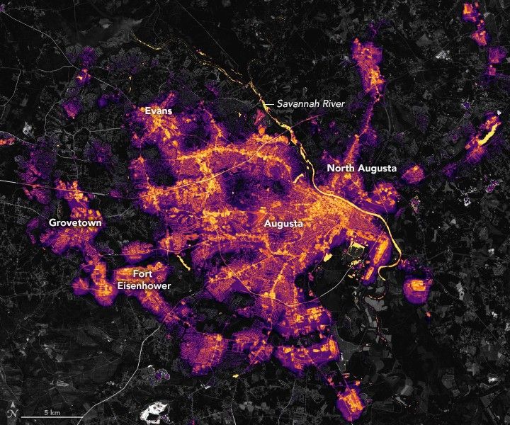
One remarkable feature is NASA’s Black Marble product suite, which utilizes data from the Visible Infrared Imaging Radiometer Suite (VIIRS). This suite offers a neighborhood-level view of electrical outages by capturing nighttime lights, something traditional mapping techniques struggle to achieve. This data is then used by emergency responders to prioritize areas needing immediate attention.
Flood Mapping and Landslide Prevention
In 2024, as hurricanes Helene and Milton approached the U.S., NASA’s scientists quickly adapted to gather crucial flood maps using data from various satellites, including European Space Agency resources. This led to accurate visualizations shared with state and federal agencies, equipping them to make informed decisions amidst rapidly changing conditions.
Moreover, NASA collaborates with the U.S. Geological Survey (USGS) to prevent landslides, a lesser-known consequence of hurricanes. The Landslide Hazard Assessment for Situational Awareness tool combines multiple satellite datasets to identify areas at risk, ensuring that emergency teams can preemptively identify and address potential threats.
NASA’s insights were crucial for assessing flooding risks after Hurricane Helene, showing the extensive impact on communities.
Advanced Data Collection Techniques
NASA employs a multitude of cutting-edge instruments to gather atmospheric and oceanographic data essential for understanding hurricanes. For instance, the TROPICS mission uses a constellation of small satellites equipped with microwave radiometers to observe storms continuously. This new method of monitoring allows for frequent updates on storm developments, particularly in their intensification stages.
The Geostationary Lightning Mapper aboard NOAA’s GOES satellites provides critical insight into rapid storm intensification through changes in lightning activity. A recent analysis showed a sharp increase in lightning in Hurricane Helene’s eyewall, signaling its escalation to hurricane status shortly before landfall.
Focus on Sea Surface Temperatures
Sea surface temperature is a crucial factor in studying hurricane conditions. NASA employs satellites like MODIS and VIIRS to create daily updated maps that help scientists and meteorologists monitor varying temperature levels across the ocean. These fluctuations play a vital role in forecasting where and when hurricanes might strengthen or weaken.
Using multiple data streams, NASA synthesizes this information with atmospheric measurements, enhancing their understanding of the complex interactions that lead to storm development.
Collaborative Efforts and Community Engagement
The breadth of NASA’s engagement doesn’t stop at data collection; the agency actively collaborates with local authorities and emergency managers to make data actionable. For example, during Hurricane Helene, early flood predictions were shared with state departments before disaster declarations, allowing communities to prepare in advance.
NASA’s work highlights its commitment not only to advancing scientific understanding but also to ensuring community safety before, during, and after significant weather events. By leveraging technology and collaboration, NASA continues to strengthen its role in hurricane preparedness and response.
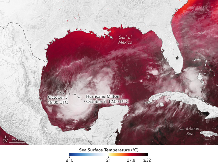
Hurricane Milton showcases the importance of monitoring ocean conditions to understand hurricane impacts.
In summary, NASA’s multifaceted approach to hurricane monitoring combines advanced technologies, real-time data collection, and collaborative efforts to ensure timely and effective responses to severe weather threats. This proactive stance not only aids in safeguarding lives but also contributes to the broader understanding of hurricanes and their impacts.
